Guide to Katla Volcano at Mýrdalsjökull Glacier
Katla is one of Iceland’s most powerful and infamous volcanoes, located beneath the Mýrdalsjökull glacier in the southern part of the country. Known for its explosive eruptions and immense size, Katla has a caldera that spans approximately 10 kilometers (6.2 miles) in diameter. Katla’s eruptions are often accompanied by massive glacial floods, known as jökulhlaups, caused by the sudden melting of the glacier ice above the volcano. These floods can have devastating effects on the surrounding landscapes, making Katla one of the most closely monitored volcanoes in Iceland.
Katla’s last major eruption occurred in 1918, and since then, the volcano has shown signs of activity, with increased seismic activity and geothermal heating, leading scientists to believe that another eruption could be imminent. Despite its volatile nature, the area around Katla is a popular destination for adventurers and nature enthusiasts, who are drawn to the stunning beauty of the Mýrdalsjökull glacier and the dramatic landscapes shaped by the volcano’s past eruptions.
Visitors to the region can explore the Katla Geopark, which offers a range of outdoor activities, including glacier hikes, ice cave explorations, and guided tours that delve into the fascinating geology and history of the area. The Katla volcano stands as a testament to the dynamic and ever-changing nature of Iceland’s volcanic landscape.
Katla Volcano Facts
-
Height: 1,512 meters (4,961 feet) above sea level.
-
Type of Volcano: Subglacial, stratovolcano.
-
Location: Southern Iceland, beneath the Mýrdalsjökull Glacier.
-
First Recorded Eruption: ~930 AD.
-
Last Eruption: 1918.
-
Number of Eruptions: At least 20 major eruptions over the last millennium.
-
Katla Volcano Ice Cave: Accessible through guided tours, offering a rare glimpse into the world beneath the glacier.
-
Katla Volcano Hike: Popular hiking trails lead to the glacier area, offering breathtaking views of Katla’s surrounding landscapes.
What type of volcano is Katla?
Katla is a subglacial stratovolcano, meaning it is a layered volcanic structure beneath an ice cap. This unique combination can lead to explosive eruptions as magma interacts with the glacial ice, resulting in sudden floods called jökulhlaups.
Is Katla Volcano active?
Yes, Katla Volcano is very much active. Although its last eruption occurred in 1918, scientists closely monitor seismic activity around Katla, as there have been numerous earthquake swarms in recent years, suggesting that an eruption could occur in the near future.
When has Katla erupted?
Here are the most notable eruptions of Katla Volcano starting from the most recent:
1918: The most recent large eruption with heavy tephra fall and a significant glacial flood. The flood deposits extended the coastline by several hundred meters.
1860: A small eruption with some damage reported in Mýrdalssandur.
1823: A small eruption with insignificant damage.
1755: A powerful eruption, the largest in Katla's recorded history. It caused a hazardous glacial flood, heavy tephra fall, and lightning from the volcanic cloud that killed people.
1721: This eruption triggered a large jökulhlaup (glacial flood), causing significant property damage and changes in local geography.
1660: A medium-sized eruption with heavy tephra fall and flooding. The farm and church at Höfðabrekka were destroyed.
1625: A powerful eruption, with tephra fall reported as far as the Faroe Islands and Trondheim in Norway, leading to significant flooding.
1612: A small eruption occurred, accompanied by a jökulhlaup.
1580: A small eruption, no reported damage.
1500: A large undocumented eruption, with heavy tephra fall across southern and southwestern Iceland, including Reykjavík.
15th century: A small, undocumented eruption, revealed by a thin tephra layer.
1440: A small eruption with sparse documentation, no reported damage.
1416: This eruption and the following jökulhlaup caused severe damage.
1357: A medium-sized eruption with heavy tephra fall, leading to a destructive jökulhlaup that ruined many farms.
1262: An eruption led to a large jökulhlaup and significant tephra fall.
1245: A small eruption occurred.
1179: A small eruption led to a glacial flood that damaged several farms.
12th century: A small eruption with sparse documentation.
939: An eruption in Katla, accompanied by a hazardous glacial flood, occurred during the tremendous Eldgjá eruption.
920: The first eruption after the settlement. Medium-sized, it is undocumented but evidenced by a tephra layer.

History and Geography of Katla
Katla Volcano has a long and violent history, with at least 20 recorded eruptions since Iceland’s settlement. The first known eruption was around 930 AD, shortly after the country’s first settlers arrived. Some of the most significant eruptions occurred in 1625, 1755, 1823, and most recently, in 1918. Katla’s eruptions are often extremely powerful, with its 1918 eruption extending the southern coastline by several kilometers due to the massive outpouring of volcanic material.
Because Katla lies beneath the Mýrdalsjökull Glacier, each eruption is accompanied by rapid glacial melting, resulting in catastrophic floods known as jökulhlaups. These floods can discharge vast amounts of water and debris, dramatically altering the landscape in a matter of hours.
The Katla volcano last eruption in 1918 was a major event, producing large volumes of ash and tephra that caused extensive flooding and reshaped parts of southern Iceland. Following the eruption, Katla's volcano caldera—roughly 10 km (6 miles) in diameter—collapsed under the ice, forming the present-day glacier-covered caldera. Despite the silence that followed the 1918 eruption, Katla remains closely monitored due to the potential for future eruptions.
Situated on the Mid-Atlantic Ridge, where the Eurasian and North American tectonic plates are pulling apart, Katla is part of Iceland’s volcanic and geothermal landscape. The nearby Eyjafjallajökull Volcano, famous for its 2010 eruption that disrupted air travel across Europe, lies just 25 km west of Katla. Some researchers even suggest that activity at Eyjafjallajökull might trigger eruptions at Katla, further heightening the region’s volcanic risks.
Katla Volcano Mythology
Þykkvabæjarklaustur monastery in Álftaver was established by Bishop Klængur in 1169, with its first abbot being St Þorlákur, Iceland's patron saint. Over time, the monastery gained a distinguished history.
A famous legend tells of an abbot's housekeeper, Katla, known for her bad temper and rumored to be a witch. She possessed magic breeches that allowed anyone wearing them to run tirelessly. Katla's cruel ways made her feared, even by the abbot.
The monastery's shepherd, Barði, often faced Katla's wrath when sheep were missing. One autumn, while Katla and the abbot were away, Barði couldn't find the sheep. In desperation, he wore Katla's breeches, found the flock, and brought them home.
Upon her return, Katla realized what Barði had done. Furious, she drowned him in a vat of whey, hiding his body. As time passed, the whey level dropped, and Katla feared the shepherd's body would be discovered. She fled northward, eventually throwing herself into a canyon, now known as Katla’s Canyon.
Shortly after, a massive flood rushed from Mýrdalsjökull glacier, giving rise to the belief that Katla, the witch, caused the glacier’s floods. The notorious volcano beneath the glacier now bears her name: Katla.
Katla Volcano Location
Katla is located in southern Iceland, beneath the massive Mýrdalsjökull Glacier, around 25 kilometers (15.5 miles) east of Eyjafjallajökull. The glacier covers Katla’s vast caldera, making it both a hidden and potentially explosive force in Iceland’s volcanic system.
-
GPS Coordinates: 63°38'49.9"N 19°07'49.0"W
How to Get to Katla
Although Katla Volcano itself is not directly accessible due to its location under the Mýrdalsjökull Glacier, you can visit the surrounding area and even take tours that lead to the Katla Volcano ice cave and nearby hiking spots.
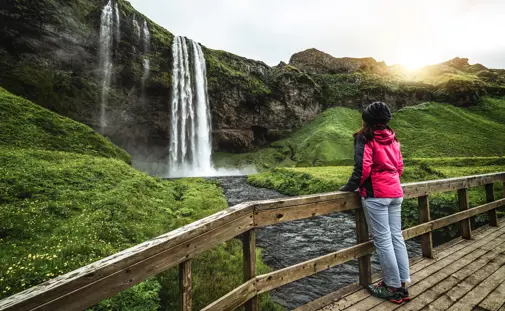
From Reykjavík, follow Route 1 (Ring Road) heading southeast toward Vík. The drive is approximately 180 kilometers (112 miles) and takes around 2.5 hours. Along the way, you’ll pass numerous scenic stops, including the famous Skógafoss and Seljalandsfoss waterfalls.
Although you can’t drive up to the volcano itself, you can view Katla and its surrounding glaciers from various points on the Ring Road, especially near Vík.
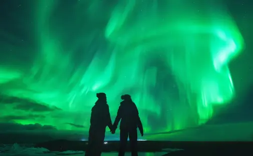
Katla Volcano and the Northern Lights
Due to Katla’s remote location and minimal light pollution, the area around the volcano offers some excellent opportunities to view the Northern Lights during the winter months. The dark skies over the Mýrdalsjökull Glacier provide a stunning backdrop for the aurora borealis, making this a popular spot for winter adventurers hoping to see the lights while exploring Iceland’s volcanic landscapes.
Closeby spots where you can view the northern lights over Katla and Mýrdalsjökull are:
-
Sólheimasandur
-
Vík í Mýrdal (it's better to go to the beach or just outside the town away from light pollution)
-
Hjörleifshöfði