Dyrhólaey - Iceland's Rock Arch
Dyrhólaey, located on the southern coast of Iceland, is one of the country’s most recognizable and scenic landmarks. Known for its dramatic views, towering cliffs, and the stunning Dyrhólaey rock arch, this natural promontory draws visitors from around the world. Originally called Cape Dyrhólaey, this area offers panoramic views of Iceland’s rugged coastline, the black sand beach, and the surrounding Mýrdalsjökull Glacier. The striking contrasts between the land and sea make Dyrhólaey an unforgettable stop on any Icelandic adventure.
Dyrhólaey Facts
Dyrhólaey is unique not just because of its natural beauty but also due to its geologic significance and historical relevance. Here are some key facts about the area:
- Height: 120 meters (394 feet) above sea level.
- Location: Southern coast of Iceland, near the town of Vík.
- Formation: Formed during a volcanic eruption approximately 100,000 years ago, creating the Dyrhólaey arch and promontory.
- Nature Reserve status: 1978
- Dyrhólaey Lighthouse: Built in 1910 and rebuilt 1927, the lighthouse sits atop the cliffs and provides sweeping views of the coastline.
- Wildlife: During summer months, Dyrhólaey is home to large colonies of puffins and other seabirds.
- Through the hole: A daredevil pilot flew a small plane under the arch and through the hole.
What makes Dyrhólaey so special?
It's the unusual shape of Dyrhólaey that immediately attracts visitors to it. Its defining feature is a gigantic arch-shaped rock formation that juts out into the Atlantic Ocean. Basically, a hole through the rock, big enough to sail through on calm days.
On a second look, visitors will notice more imminent features of Dyrhólaey besides just its rugged good looks. The views are superb. Visitors will get an aerial view of the black sand beach, the Reynisdrangar sea stacks and on a clear day, the Mýrdalsjökull glacier. There’s no wonder that puffins have made these cliffs their home. Visitors can observe these adorable seabirds as they nest in the cliffs, which also makes Dyrhólaey a birdwatcher’s paradise.
So, what makes Dyrhólaey special is the combination of its natural arch, panoramic views, fascinating wildlife, and its role as a symbol of Iceland’s dynamic geology.
Dyrhólaey Formation and Geology

Dyrhólaey was formed around 100,000 years ago after a volcanic eruption, whereby the lava flowed into the cool sea and solidified. Made out of basalt, this huge promontory has been slowly whittled off in many thousands of years by the ocean that carved out the outstanding arch to constitute present-day Dyrhólaey.
The cliffs and arches at Dyrhólaey are volcanic rock, mostly basalt; this can be viewed in gigantic hexagonal columns, visible in other places near Dyrhólaey, such as Reynisfjara Beach. The specific geology of the area created not only the physical structure but also the dark and rugged characteristics of the land.
What to expect at Dyrhólaey
A visit to Dyrhólaey promises great views, coastal beauty, and even an encounter with Iceland's rich wildlife. Here's what awaits you when you come to visit:
Dyrhólaey Viewpoint
The Dyrhólaey viewpoint atop the cliffs offers great views in all directions. To the east, you get the iconic Reynisdrangar sea stacks rising out of the ocean off Reynisfjara Beach. To the north, the towering Mýrdalsjökull Glacier fills in much of the view. Still, on days when clouds are minimal, you even see Eyjafjallajökull, the volcano famous for its 2010 eruption. It is easily accessible from the parking areas and a must-see for photographers and nature lovers alike.
Dyrhólaey Beach
While you're not able to walk directly on the Dyrhólaey black sand beach below the promontory, the neighboring Reynisfjara Beach does offer access to those dramatic blacks sands the area is so famous for. Be very careful exploring this beach, as the waves can be very hazardous due to strong currents and sneaker waves.
Dyrhólaey Puffins
From May to August, Dyrhólaey becomes a nesting ground for puffins, one of Iceland's most beloved birds. On the close-up cliffs, visitors can catch glimpses of these charismatic seabirds-since they nest here in their burrows. Be sure to bring your camera along with you for some of the most incredible wildlife photography opportunities you might ever experience; just remember to keep your distance so you do not disturb them.
Dyrhólaey Parking
There are two main parking areas at Dyrhólaey. The first one is at Lágey where you can also find bathroom facilities and the other one is at Háey, located close to the old lighthouse.
- Háey, Lighthouse Parking: 63°24'15.9"N 19°07'45.4"W
- Lágey Parking and bathrooms: 63°24'16.7"N 19°06'23.9"W

From the parking areas, you can easily access the viewpoints and trails. Keep in mind that the road leading up to Dyrhólaey is steep and can be rough in certain weather conditions, so a 4x4 vehicle is recommended, especially in winter.

Dyrhólaey Hike
There is a nice cliff side hike from the parking lot and bathroom facilities at Lágey all the way to Háey. Visitors should be aware that the hike is a single path so you’ll be walking the same route back.
The marked path is around 2 km (1.2 miles) and takes usually between 1-2 hours.
This hiking trail offers different vantage points of the rock arch, cliffs, and surrounding landscapes. It’s considered a relatively easy hike and suitable for most visitors.
It's not always open
Note that Dyrhólaey is closed to visitors during nesting season, which includes parts of June and May. Therefore, we recommend asking at a local information center what the status is before you decide to embark on a journey to Dyrhólaey and respect marked closed areas.
Dyrhólaey and Surrounding Sights

Dyrhólaey is surrounded by some of the most spectacular natural attractions that southern Iceland has to offer. A short drive from this promontory, you find Reynisfjara Beach, known for its black sand and dramatic basalt columns. These are the Reynisdrangar sea stacks-towering rocks springing out of the ocean-which are one of the most popular sights at this beach.
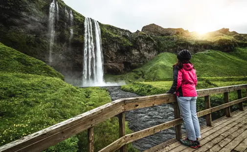
To the north, the enormous Mýrdalsjökull Glacier is a distance away. The glacier covers Katla, which is one of Iceland's most active volcanoes. Also about 30 minutes west from Dyrhólaey, the famous Skógafoss Waterfall is another contribution to the variety of travelers making their journey along the southern coast.
Map of Dyrhólaey & Surroundings
Where is Dyrhólaey?
Dyrhólaey is located on Iceland’s southern coast, approximately 174 kilometers (108 miles) southeast of Reykjavík and about 20 kilometers west of the town of Vík. Its elevated position on the coast makes it one of the best places to view the rugged coastline, including the Dyrhólaey arch and Reynisfjara Beach.
- GPS Coordinates for Dyrhólaey Viewpoint: 63°24'05.5"N 19°07'42.7"W
How to Get to Dyrhólaey
To reach Dyrhólaey from Reykjavík, take Route 1 (Ring Road) heading east toward Vík. After passing Skógafoss Waterfall, look for the signpost indicating the turn-off for Route 218, which will lead you directly to Dyrhólaey. The drive from Reykjavík takes about 2.5 hours and offers stunning views along the way.
If you’re visiting from Vík, Dyrhólaey is only a 20-minute drive west along the Ring Road. Once you reach the turn-off for Route 218, a steep road takes you up to the promontory. The area is accessible year-round, but a 4x4 vehicle is recommended during winter months due to snow and ice on the road.